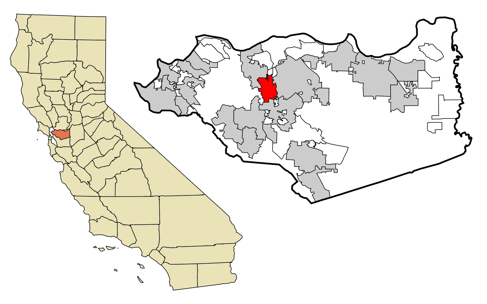
The red shape on a Contra Costa County locator map marks Pleasant Hill's incorporated territory. It is a compact footprint surrounded by other cities and unincorporated land, a useful picture of the choice residents made in 1961. Incorporation did not create the community from nothing. It gave an already developing place a municipal boundary, elected government, and a direct role in decisions that had previously rested elsewhere.
Farms, roads, and rail came before city hall
Pleasant Hill's historical account traces local roots to farms established in the late nineteenth century. A railroad reached the area in 1891, followed by electric rail service in 1911. Those transportation links helped connect homes and agricultural land with nearby commercial centers. By the decades after World War II, subdivision and population growth were changing the landscape much faster than the earlier rural pattern.
Residents faced a practical question about who would govern that growth. In 1959, voters rejected annexation to Walnut Creek. The decision left open an alternative: create a city centered on Pleasant Hill itself. Organizers developed an incorporation proposal, identified a workable territory, and placed the question before voters two years later. The boundary on the modern map is the continuing geographic result of that campaign.
A November vote established the city
On November 7, 1961, local voters approved incorporation. Pleasant Hill then became a general-law city with a council responsible for municipal policy and a manager overseeing administration. Incorporation supplied local institutions for land-use decisions, streets, public safety agreements, budgets, and services while the community continued to grow within the larger county.
The locator map also prevents a common geographic shortcut. A familiar name may describe schools, shopping areas, postal addresses, or transportation facilities beyond the legal city line. Municipal action applies within a defined jurisdiction, while county or neighboring-city agencies may govern the next parcel. Checking an exact address against current official records is more reliable than relying on a neighborhood label alone.
The outline still needs current interpretation
A municipal locator deliberately simplifies what lies inside the red shape. It does not show parcel lines, terrain, individual buildings, annexation history, or the boundaries of every service district. Residents using city records should pair the overview with current parcel, permit, zoning, and emergency information for the exact address. The map's job is orientation: it identifies Pleasant Hill as a legal city within the county and makes clear that the incorporation decision has a geographic edge.
For a home-insurance review, use that exact address with current construction, roof, foundation, utilities, occupancy, square footage, permitted improvements, detached structures, and rebuilding estimates. Condominium owners should also compare the association's master policy with their responsibility for finishes and assessments. Keep photographs, receipts, permits, and an inventory available after a loss, then read limits, deductibles, water provisions, loss of use, ordinance-or-law coverage, exclusions, inspections, and claim duties. The 1961 boundary identifies the municipal government; eligibility and coverage follow the submitted property facts, carrier rules, and policy forms actually issued.